Relief map route network
Relief map route animation: a red road spreads from a village to a port and along a golden-hour coast. Copy the prompt into Claude and edit places.
The camera skims low over a mountain village on a plaster relief model under a golden-hour sun. The surrounding province inks in green, the year counter rolls on, and a glowing red route drains to the port and spreads along the coast in pulses. Feeder roads and dashed ferries bloom as the camera lifts to a titled poster.
Ask Claude to change the three years, the origin village, the region, the port, the peninsula town, the inland city and the south-coast town, plus route, region and sea colours. Works for documentary maps on expansion, trade, rail or distribution at 16:9, in a presentation or on YouTube.
Use it for
- Company expansion route map
- Documentary history map sequence
- Trade network explainer
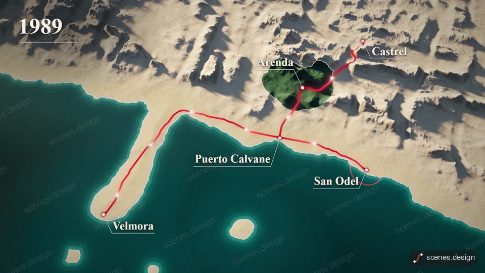
Category: Maps. Format: widescreen 16:9.
How to use this scene in Claude
Copy the scene's prompt into claude.ai or the Claude app and Claude builds it as a live preview. For an MP4, pull the scene into Claude Code and render it on your own machine with npx hyperframes render. Or add the Scenes connector (https://scenes.design/mcp) to Claude and just ask for the scene. Full steps: Docs.